Wednesday 28 February 2018

Natural Areas of Chatham-Kent, Part 8 (Fletcher Ponds)

Now that the flooding has subsided, I will return to the Natural Areas series. This is another place that probably the vast majority of C-K residents have never heard of. It isn't large and there isn't even a sign at the access point. I'm not even sure if there is an official name for it, but it is a restored/created natural area by the community of Fletcher, so I have taken the liberty of naming it Fletcher Ponds.
It is located along the Merlin Town Line, which is between Chatham and Tilbury, south of Hwy 2/Longwoods Road. Just a few kilometres south of Hwy 2 is the village of Fletcher, and at the south end of the village is the Fletcher United Church. Just beyond the church is a small parking lot, marked with 'X' on the photo map above. A lane leads beyond the parking lot, but it will be closed off by a gate. However there is a pedestrian access beside the gate, and from there you can walk the ~150 metres or so to the edge of this natural area.

The blue line on the photo depicts the boundary of this site as far as I am aware. The red line shows the grassy/gravel trail location.

I'm not sure of all the history of this site, but part of it was at one time used as a local landfill. That area is covered over and not within the accessible area. A couple of decades ago, the larger landholding was restored by creating ponds and trails and planted with shrubs and other vegetation.

It doesn't take a long time to explore this site via the trail, but it can be an interesting short stop. I visit it several times a year, but have yet to see anyone else there.

Since it is surrounded by agriculture, other than the abandoned railway line to the north of it, the vegetation works as a magnet for wildlife passing through C-K, such as migrating birds. Due to the varied shrubby and open areas in addition to the ponds, a reasonable diversity of wildlife can be found.

Birds which likely nest here include:
Brown Thrasher
Great Horned Owl
Northern Mockingbird
Yellow Warbler
Northern Flicker
Swamp Sparrow
Warblers, vireos and other species can be found on migration. There is a total of about 70 species of birds which have been recorded here to date.

There are several ponds which the trail system goes by, providing a look into whatever is happening at the time.

Canada Geese, not surprisingly, are here.

Turtles are fairly common, especially on warm and sunny days.
In the mid summer it is a good time to look for Climbing Prairie Rose, a species ranked Special Concern and therefore rare in Ontario and Canada.
With parts of the site fairly open, there is good habitat for milkweeds, asters and goldenrods which are popular with various species of butterfly. Monarch butterflies, considered Endangered in Ontario and Canada, are found here during the summer and especially as they begin their migration to points much farther southwest.

Fletcher Ponds....another small but interesting natural area worth exploring in Chatham-Kent!


Sunday 25 February 2018

Thames River Flood in Chatham

Perhaps you have been deluged with photos of the recent flood of the lower reaches of the Thames River. Here are a few more.

The Thames River watershed is massive, draining approximately 5800 square kilometers. With all of the rain received in the watershed in the last few days, as well as the warm weather causing rapid melt of the higher than average snow pack, all that water has to go somewhere, and that somewhere is down through Chatham-Kent before the river empties into Lake St. Clair.

It has hit Thamesville and Chatham particularly hard. An interesting short video can be seen here.

I've checked out the flooding from several vantage points. One of the more accessible ones is the Third Street Bridge. This first shot looks towards Thames Street, which is totally flooded, and you can see well off to the right where the river is supposed to be. It has overflowed the banks by at least 100 metres at this point, it seems. (Click on any of the photos to get a larger view).


Towards Thames St with the flooded parking lot on the right
 This next shot shows the entrance to Thames St, just south of Harvey's (which was open the entire time, and sometimes quite busy, too).
 There was no one lining up to pay for non-existent parking!
 The bridge abutments managed to snag some debris, causing a slight damming effect.

Looking straight down Thames St

Looking to the south side of the river, from the Third St bridge
 This next photo is looking straight upstream, towards the Fifth St Bridge, which is under construction and barely above the water level.

 This next shot shows the entrance to the promenade on the south side of the river.

This next photo is looking downstream from the Third St Bridge. The tallest building on the left is the Civic Centre, and the complex of buildings on the right is the hospital. Fortunately the hospital side is a little higher so less threatened than the opposite side.

These next three photos were taken from the waterfront at the Civic Centre. The first one shows part of the former YMCA parking lot, with the hospital in the background across the river.

This one is directly in front of the Civic Centre, with a small building and a stairway in the water. The actual Civic Centre grounds did not appear affected, although there was some water in the Centre's closed off underground parking area.
 Across the river between the Civic Centre and the Third St. Bridge are some houses that normally would have a nice waterfront setting. Note the 'above ground' swimming pool almost completely underwater.

These next two photos were taken from the Lower Thames Valley Conservation Authority headquarters. The first photo looks towards the Fifth St Bridge which is under construction. Note the top of the picnic table. It wasn't apparent whether it was floating or not.

Next is from the waterfront deck of the LTVCA HQ, looking across to Tecumseh Park. Most of the park is high enough so as not to be affected by the current water level, although the walkway along the water's edge is completely submerged. A street on the left goes to the water's edge, but is blocked off.

A bit farther upstream is Thames Grove Conservation Area. There is a boat launch, a picnic area and walking trail and lots of open space. It is where the tremendously popular War of 1812 Re-enactment event took place in the fall for quite a few years. There is housing that backs right on to the CA. Now much of the CA is completely underwater and has also affected back yards. I'm not sure how basements fared, but there were some that had hoses out the basement window which had been pumping out water!

In this first photo, note the top of a large picnic shelter through the trees, barely sticking above the water.
 The water came close to some houses.
 Many back yards were at least partially submerged, and this photo was taken a few hours after the water had peaked.
 A couple of Mallards were using some debris to take a rest.
With winter winding down and spring just a few weeks away, hopefully this is the worst we will see!


Saturday 24 February 2018

Positives and negatives of all that rainfall

There is no question that the last few days have had many people concerned in the Great Lakes Region. With the warm weather and substantial amounts of rainfall quickly melting the snow pack, there is a lot of water on the landscape!

I've been up along the St. Clair River a couple of times recently, partly hoping to see the King Eider that had been hanging around the north end of Stag Island for a few days. I didn't catch up to it, but saw lots of other waterfowl. The warm weather and rainfall has certainly cleared out a lot of the ice.

A Horned Grebe, hanging out in the vicinity of the Chenal Ecarte at the bridge that goes to Walpole Island First Nation was a bit of an early arrival.
 Common Mergansers were quite common.
 There was the occasional Hooded Merganser.
 Long-tailed Ducks used to be a novelty on this river, but for the last decade or so, have become much more common. Several hundred, sometimes more, are scattered somewhere along the river on any given day.
 Red-breasted Mergansers aren't as abundant as their Common relatives, but a few can be found.
 Redheads are frequently seen, sometimes in large rafts.
Canvasback are reliably seen, although this year they haven't been nearly as common as Redhead.

I saw three Bald Eagles also, all immatures, but not well enough to try for a photo. A Great Blue Heron flushed up from a warm water outflow just south of Bickford Line. No photo there either.

While driving south along the river, I looked over at the edge of a woodlot which belongs to the family of a friend. I knew Wild Turkeys hung out there, as it is within my usual territory for the Christmas Bird Count. Sure enough there were a couple of dozen roaming around in the field just beyond the woods.


With all the rainfall, I knew that the McKeough Floodway would be in use. It was constructed in 1984 in response to the major flooding that Wallaceburg often experienced. The floodway re-directs excess water from the East and North Sydenham Rivers before it gets to Wallaceburg, thereby alleviating some of the flood risk. Sure enough, there was a lot of water flowing through the floodway and entering the St. Clair River safely away from Wallaceburg.
Floodway looking 'upstream' from Baseline Road
 After viewing the floodway I returned home via West Holt Road heading over to Hwy 40. I was pleased to see a Snowy Owl sitting cooperatively on top of a hydro pole, which allowed me to get some reasonable shots.
Upon arriving home on one of these occasions, before all the snow had disappeared, I was surprised to see Am Robins hanging out in our yard. At least a dozen were there, taking turns searching in the leaves near the base of the house which hadn't been covered with snow. They hung around for several days until most of the snow was gone, scattering to other snow-free areas.


Waterfowl were arriving in greater numbers in the vicinity of St. Clair NWA, as expected. I checked them out and saw many of the usual overwintering species, but caught up with Snow Geese and Greater White-fronted Geese as well, although they were too far away to bother with a photo. I did capture these Northern Pintail, however. The occasional one had been around all winter, as had Gadwall, Green-winged Teal and Am Wigeon, but there was definitely an influx of them in the last few days.
The flooded fields were very attractive to waterfowl.

They were much less attractive to the farming community. This part of Chatham-Kent is extremely flat, due to the outwash of receding glaciers a long time ago. This highly productive area dominated by rich black soil is a result of the wetland or prairie vegetation that developed here after the glaciers left. If the water levels of adjacent Lake St. Clair was high, it would be wetland; in periods of lower water level, it would be dominated by wet tallgrass prairie vegetation. But it has very poor natural drainage, so farmers do everything they can to remove standing water as quickly as possible. Pumping stations are strategically located, and in these last few days every one of them has been in operation where tractor powered pumps are going full tilt pumping the water off the fields, through the tile drains, and emptying the offending liquid into the larger drain system.
 This particular photo was taken along Town Line Road and empties into Lake St. Clair at St. Luke's which is the north end of Town Line Road.

The Erieau area is always worth checking out due to the wetlands and waterfront there. Again, this time of year waterfowl are the most abundant bird species. It wasn't many days ago where the extensive ice conditions limited open water to these birds. The main channel often had a bit of open water.
A lone Gadwall was there, hanging out in the vicinity of Am Black Ducks.

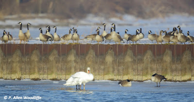
A four-legged Mute Swan?
On one of the warmer days I was there, the fog had rolled in making views much more challenging, so I opted for a different kind of photography.

I did see some waterfowl resting and feeding in the wet fields adjacent to McGeachy Pond just outside of Erieau. The fog wasn't quite as thick, but still made viewing and photography challenging. I got these three Greater White-fronted Geese under much less than ideal conditions.


On the way home I decided to check out the Indian/McGregor Creek diversion that protects the south end of Chatham from flooding. It is much smaller than the McKeough Floodway mentioned earlier, but the Indian/McGregor Creek watershed is much smaller than the combined East and North Sydenham Rivers. It wasn't that many decades ago when residents of south Chatham greatly feared the weather conditions we have been experiencing these last few days, as late winter and early spring flooding was almost a regular event. There hasn't been any serious flooding in that area since 1992 when this floodway project was completed. This first image shows McGregor Creek at the corner of Hwy 40 and Boundary Line, looking south. The creek at this point is normally less than 5 metres wide at the bottom with only a little water flowing. Here it is probably well over 100 metres wide.
 This next photo shows McGregor Creek at the corner of Maynard Line and Creek Road. It clearly looks more like a small lake than a creek!
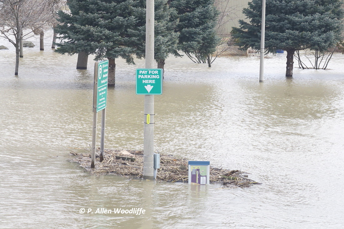
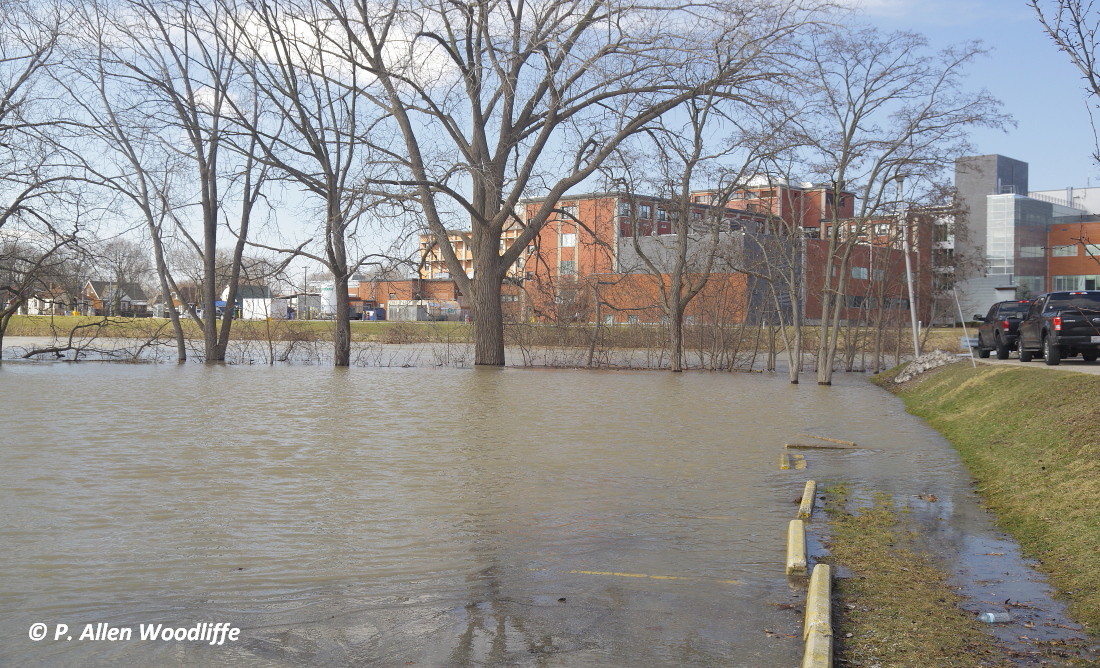
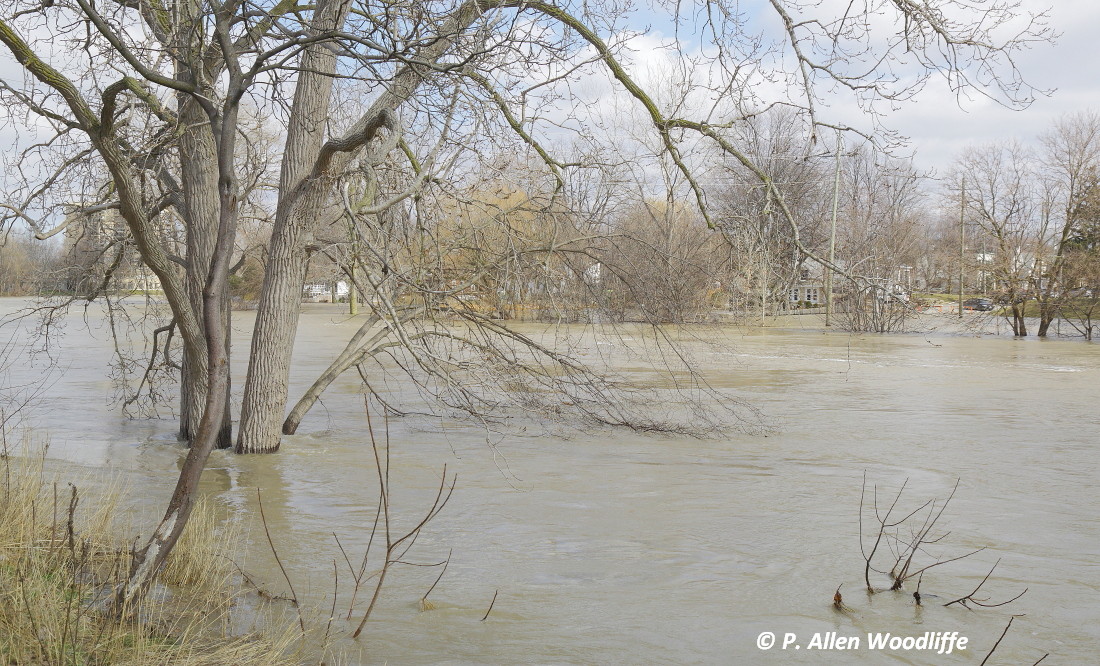
Flooding to some extent does still occur in the immediate area of downtown Chatham. Here is an impressive aerial video of downtown Chatham taken today, Feb 24 just before peak water levels of the Thames River arrive. This video has now been taken down by the owner, unfortunately. But this one shows another section of the river flood downstream from the downtown.